
Mendenhall Glacier
An Alaskan landscape thousands of years in the making
The Quick Facts
Alaska, USA
Juneau (approximately 12–13 miles away)
Around 58.49° N, 134.53° W
About 1.5 miles (2.4 km) wide
More than 100 feet (30 meters) high at its terminus.
Southern half of the Juneau Icefield in southeastern Alaska
1.5 miles (2.4 km) long
1 mile (1.6 km) wide
220 feet (65 m) depth near the Mendenhall Glacier’s terminus
~17,000 Years Ago
A Valley Carved By Ice
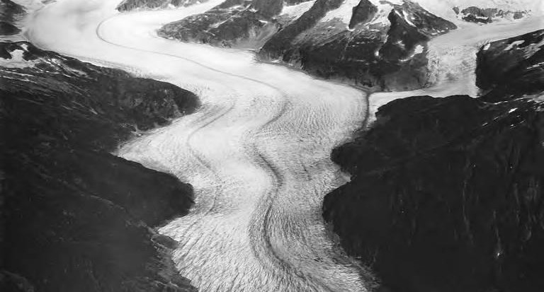
During the late Pleistocene, a much larger mass of ice occupied the Mendenhall Valley. USGS research indicates that ice in the valley was once roughly 1,200–1,500 meters thick before beginning to recede around 17,000 years ago. Its movement helped carve the broad U-shaped valley visible today.
~1300s
The Glacier Advances
As Southeast Alaska grew cooler and wetter, Mendenhall Glacier advanced down the valley. USGS research dates the start of this major advance to roughly 700 years ago.

1760–1900
Mendenhall Lake Takes Shape
As the glacier retreated, the landscape behind it changed dramatically. Water accumulated behind glacial deposits, eventually forming what would become Mendenhall Lake. Between roughly 1760 and 1900, the glacier retreated into the lake basin. Water eventually breached the moraine and established the modern Mendenhall River.
Tlingit Homelands
The Glacier Before “Mendenhall”
~1760s
Reaches Its Maximum
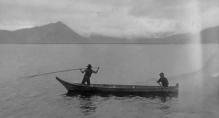
Long before American explorers mapped the area, the glacier and surrounding landscape were known to the Indigenous Tlingit people of Southeast Alaska. Tlingit names recorded for the glacier include Sitaantaagu, commonly translated as “Glacier Behind the Town,” and Aak'wtaaksit, “Glacier Behind the Little Lake.”

Mendenhall Glacier reached approximately its greatest extent in the last several centuries around the mid-1700s. Geological evidence indicates it reached its terminal position before about 1765. After this point, the glacier began its long-term retreat, interrupted by a relatively small readvance during the 1800s.
1879
John Muir Visits
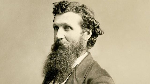
Naturalist John Muir visited the glacier in 1879 during his travels through Southeast Alaska. He called it Auke Glacier, a name associated with the local Aak'w Ḵwáan Tlingit people. Historical USGS records confirm Muir's 1879 visit and use of the Auke name.
1892
The Name “Mendenhall Glacier”

The U.S. Coast and Geodetic Survey renamed Auke Glacier in honor of Thomas Corwin Mendenhall, a physicist and superintendent of the agency.
.jpg)
1893
An Early Photographic Record
By the end of the 19th century, photographs and surveys began documenting Mendenhall's changing landscape. A surviving 1893 photograph by W. Ogilvie shows Mendenhall Valley, the glacier, and the drainage channels of the time. These historical records are especially valuable because scientists can compare them with modern imagery.
1910–1949
Retreat Accelerates

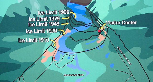
USGS historical research found that the glacier retreated roughly 1.5 kilometers between 1910 and 1949, averaging nearly 40 meters per year. As the glacier pulled back, newly exposed terrain around the lake gradually became colonized by plants and eventually forest.

1962
A Visitor Center Opens
Mendenhall's growing popularity led to a major milestone in 1962: construction of the Mendenhall Glacier Visitor Center. It was the first visitor center built in the National Forest System. Originally designed mainly as an observatory where people could escape the rain and view the glacier, it was intended to accommodate about 23,000 visitors per year.
2011
Glacier Flooding Begins

Starting in July 2011, significant glacial lake outburst floods occurred in Suicide Basin, adjacent to Mendenhall Glacier. As ice retreated, a lake formed from rainfall, snowmelt, and ice melt. Water escaped rapidly into Mendenhall Lake and the Mendenhall River. NOAA records about 39 releases from July 2011 to August 2024, though not all caused significant flooding.

Today
Mendenhall Continues to Change
Mendenhall Glacier is not a static landmark. Its retreat continues to reshape Mendenhall Lake, surrounding forests, waterways, habitats, and the way visitors experience the landscape. What visitors see today represents only one moment in a story stretching back thousands of years.
