
Juneau Icefields
A Frozen World Beyond the Mountains
Geography Of The Juneau Icefield
The Juneau Icefield covers a mountainous region along the Alaska–Canada border. Its interconnected snowfields and glaciers flow through valleys, shaping the surrounding landscape. Its location and elevation help maintain large accumulations of snow and ice, although conditions vary across the icefield.


Topography
Climate
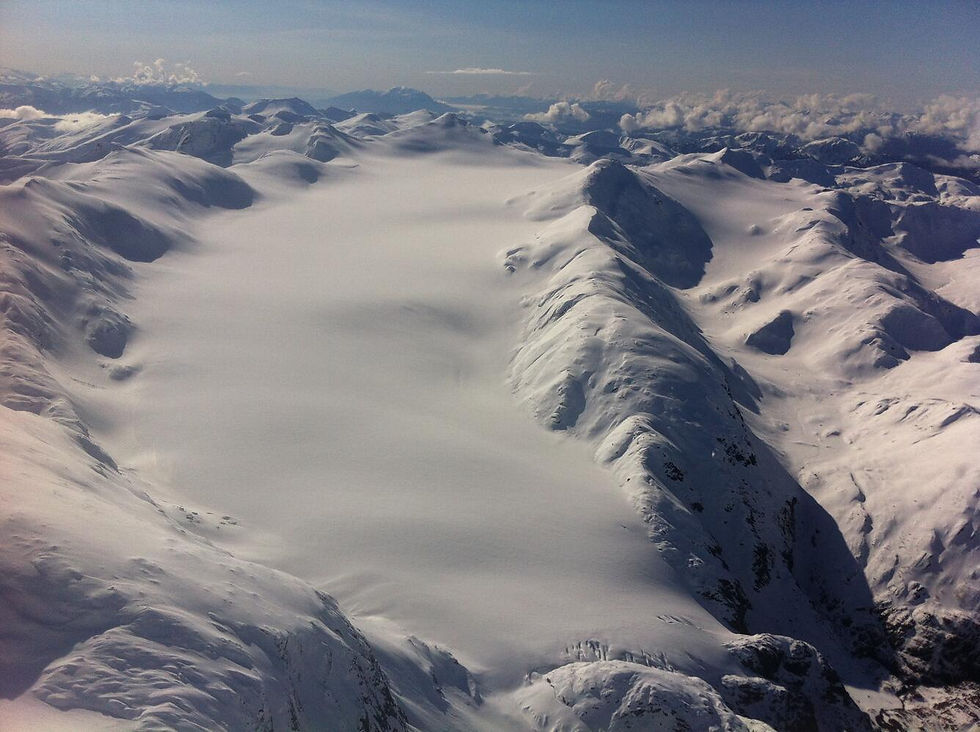
The Juneau Icefield features broad, gently sloping ice-covered plateaus, rugged mountain peaks, deep valleys, and steep glacier icefalls. Its elevation ranges from near sea level to approximately 2,300 meters (7,550 feet).
Much of the icefield's snow accumulation occurs across its elevated plateaus. From these areas, glaciers flow downhill through mountain valleys, often passing over steep slopes where the ice fractures into crevasses and icefalls.
The terrain plays an important role in determining how glaciers move, how snow accumulates, and how quickly different parts of the icefield respond to changing environmental conditions.
The Juneau Icefield experiences a cool, wet maritime climate strongly influenced by the nearby Pacific Ocean. Moist air carried inland from the Gulf of Alaska rises over the Coast Mountains, cools, and produces heavy precipitation.
At higher elevations, much of this precipitation falls as snow, helping replenish the icefield. Lower elevations are warmer and melt more, especially during the summer months.
Climate conditions also vary across the icefield. The western side generally receives more moisture from Pacific storms, while the eastern side is drier because of the rain-shadow effect created by the mountains.
Flowing toward Mendenhall Lake, this glacier is one of the icefield's most recognizable outlets and a popular destination near Juneau.
Mendenhall Glacier

Taku Glacier
Taku Glacier, one of the largest outlet glaciers of the Juneau Icefield, is an important site for research on glacier movement and mass balance.

Located near Juneau, Lemon Creek Glacier has been studied for decades to measure changes in snow accumulation, melting, and overall ice mass.
Lemon Creek Glacier
Popular Glaciers Of The Juneau Icefield
The Juneau Icefield feeds more than 40 large valley glaciers and over 100 smaller glaciers that move outward from its central accumulation areas. Although these glaciers share a common icefield system, each follows its own path through the surrounding terrain.
Juneau Icefield Research Program
The Juneau Icefield has been an important site for glacier research since the 1940s. Established in 1946, the Juneau Icefield Research Program (JIRP) has brought together scientists, educators, and students to investigate the region's glaciers.
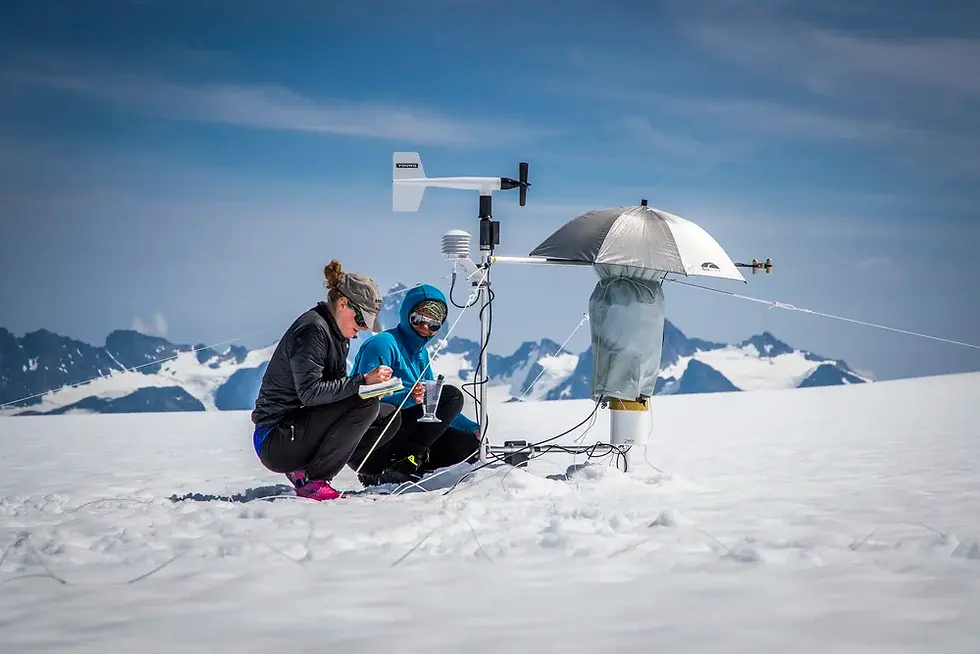
Researchers travel across the icefield to collect measurements of snowfall, ice thickness, glacier movement, and changing surface elevations. Using weather stations, GPS surveys, radar, and other scientific equipment, they gather information about how the icefield changes over time. Long-term research helps scientists better understand glacier behavior, regional climate patterns, and the environmental effects of ice loss.
.webp)
Want To Explore The Icefield?
The Juneau Icefield features a remote and dramatic landscape that has attracted explorers, mountaineers, and scientists for generations. Although much of the icefield is challenging to access, guided flightseeing trips and specialized expeditions provide opportunities to experience its vast scale.